For centuries, the idea that continents could move was dismissed as scientific heresy. Today, we not only accept plate tectonics as fact but have developed tools to measure their movements down to the millimeter. The concept of a "Continental Drift Clock" isn't about telling time in the traditional sense—it's about visualizing the relentless dance of tectonic plates that continues to reshape our planet.
Modern geodesy, the science of measuring Earth's geometric shape, has given us unprecedented insight into these movements. Networks of GPS stations, satellite radar interferometry, and laser-ranging technologies now allow scientists to track continental drift with astonishing precision. What emerges is a dynamic picture of our planet's surface, where even the most stable-seeming landmasses are in constant motion.
The Mechanics Behind the Movement
Earth's lithosphere—the rigid outer shell comprising the crust and upper mantle—is broken into about fifteen major plates that fit together like a jigsaw puzzle. These plates float atop the more ductile asthenosphere, driven by convection currents in the mantle below. The rates of movement vary dramatically, from the breakneck 10 cm per year of the Pacific Plate to the sluggish 1 cm per year of some continental plates.
At mid-ocean ridges, where magma wells up to create new crust, plates diverge. Along subduction zones, where one plate dives beneath another, continents converge. Transform boundaries see plates grinding past each other horizontally. Each type of boundary leaves its distinctive mark on the planet's surface over geological time, building mountains, creating ocean basins, and triggering earthquakes.
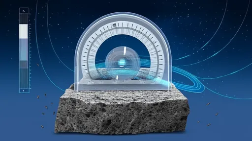
Measuring the Immeasurable
The challenge in creating a "real-time" display of plate movements lies in the timescales involved. Human perception operates on a scale of seconds, while plate tectonics unfolds over millions of years. Modern measurement techniques bridge this gap by detecting movements that would otherwise go unnoticed.
Continuous GPS stations anchored in bedrock can detect movements as small as a millimeter per year. Satellite-based radar systems measure ground deformation over vast areas by comparing phase differences in radar waves reflected from the surface. Together, these technologies create a web of observations that feed into sophisticated models of plate motions.
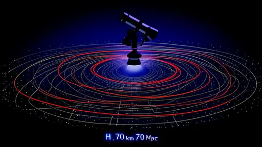
Visualizing the Drift
The Continental Drift Clock concept takes these measurements and presents them in an intuitive format. Imagine a global map where arrows show both the direction and speed of plate movements, updated continuously from geodetic data. Cities slowly migrate across the display—Los Angeles creeping northwest toward San Francisco at about 5 cm per year, Tokyo inching toward the Marianas Trench.
Such visualizations make abstract geological processes tangible. They show how the Atlantic Ocean widens by about 2.5 cm annually as North America and Europe drift apart. They reveal how India continues its northward march into Asia, still pushing up the Himalayas 50 million years after the initial collision.
Implications Beyond Geology
Understanding plate motions isn't just academic. These measurements help refine earthquake hazard assessments by revealing where strain accumulates along fault lines. They inform volcanic risk evaluations by showing how magma sources relate to moving plates. Even engineering projects—from undersea cables to long-span bridges—must account for the shifting ground beneath them.
On longer timescales, tracking plate movements allows predictions of future continental configurations. In 250 million years, Earth's landmasses may reunite as a new supercontinent—whether we call it Pangaea Proxima, Novopangaea, or Amasia depends on which current plate motions persist.
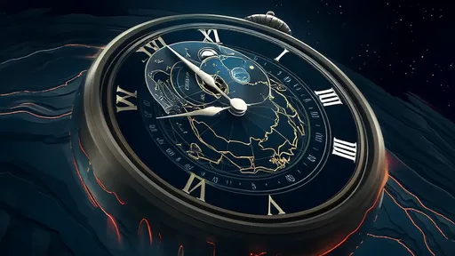
The Human Dimension of Geological Time
The Continental Drift Clock confronts us with the vastness of geological time. What appears as real-time movement represents speeds that make glaciers look swift. Yet these imperceptible shifts accumulate into continental-scale changes over millennia. The clock metaphor helps bridge the cognitive gap between human experience and planetary processes.
Perhaps most profoundly, this technology makes us witnesses to Earth's ongoing transformation. We can now observe changes that previous generations could only infer from fossils and rock layers. In doing so, we gain not just scientific knowledge but a deeper connection to our dynamic planet—a world where even the ground beneath our feet is part of an endless journey.
By /Jul 31, 2025
By /Jul 31, 2025
By /Jul 31, 2025
By /Jul 31, 2025

By /Jul 31, 2025
By /Jul 31, 2025

By /Jul 31, 2025
By /Jul 31, 2025
By /Jul 31, 2025

By /Jul 31, 2025

By /Jul 31, 2025

By /Jul 31, 2025
By /Jul 31, 2025
By /Jul 31, 2025
By /Jul 31, 2025
By /Jul 31, 2025

By /Jul 31, 2025

By /Jul 31, 2025
By /Jul 31, 2025
By /Jul 31, 2025